Description
Radar investigations of glaciers rely on accurate identification of layer features in radar survey images (radargrams).
Traditionally, these features have been identified (”picked”) manually or semi-manually. To improve the efficiency and consistency of this picking process, we present an automated method to identify the glacier surface and glacier-bedrock interface in radargrams.
This method identified 99.9% of surface layer points and 84% of bed layer points within within 20 pixels of accuracy.
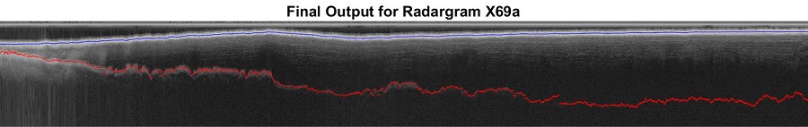
result1

result2
Identification And Analysis Of Websites Selling Counterfeit Goods
David –
Outstanding work!